Groundwater levels
Our main water sources
70% groundwater
As rain soaks through the ground it is stored in 'aquifers'. We pump this water (groundwater) to the surface where it is treated and supplied to you.
23% rivers
We take water from rivers to fill our reservoirs, or to pump directly to water treatment works for supply. More than 15% of the water we take from rivers comes from recycled water which has been cleaned at our wastewater treatment works and released into the river.
7% reservoirs
We have four reservoirs, the largest is Bewl Water on the Kent/Sussex border, followed by Weir Wood, Darwell and Powdermill in Sussex.
Drought triggers
The drought status in any area is based on several factors including historic rainfall, groundwater and reservoir levels. If a groundwater drought trigger level is met this does not necessarily mean the overall drought status has changed.
Drought trigger curves are based on those in Southern Water’s current Drought Plan.
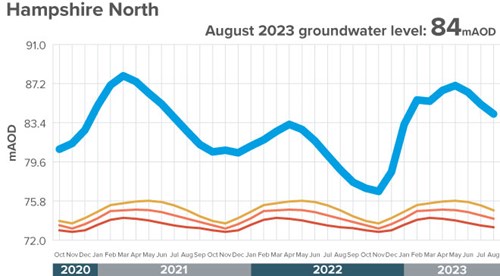
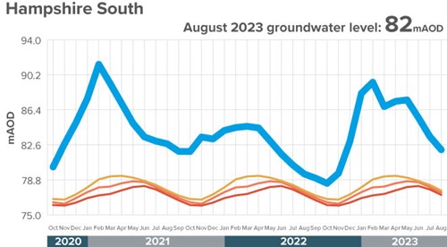
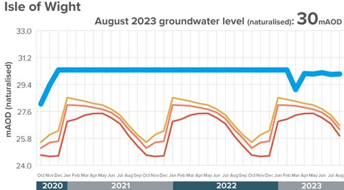
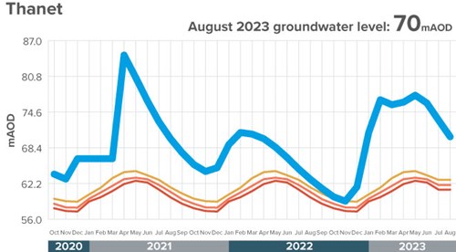
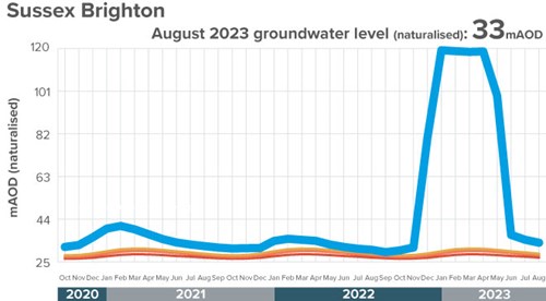
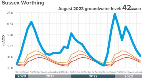
Measurements
Groundwater is measured in Metres Above Ordnance Datum (mAOD). mAOD is based on the mean sea level at Newlyn in Cornwall and is used as the reference point to calculate height above sea level in the UK.
See the current groundwater levels below:
Contains Environment Agency information © Environment Agency and/or database right.